
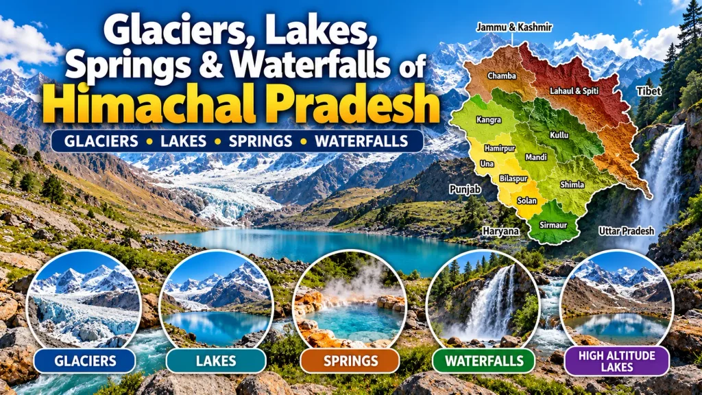
Glaciers, Lakes, Springs & Waterfalls of Himachal Pradesh
Study the important glaciers, lakes, hot springs and waterfalls of Himachal Pradesh with district-wise facts, locations, altitudes, associated rivers and exam-focused revision points.
Water Resources of Himachal Pradesh
Himachal Pradesh has a rich network of natural and artificial water resources. Lakes are fed by glaciers, rainwater and groundwater, while glaciers provide water to rivers throughout the year. The state also has important hot springs and waterfalls, many of which are associated with the Beas and Sutlej valleys.
Glaciers of Himachal Pradesh
Glaciers are known as Shigri in the Himachali local language. A glacier forms where the accumulation of snow exceeds its removal through melting over many years, often centuries. the glaciers of Himachal Pradesh hold ice reserves of 34,000 sq km, equivalent to 18% of India’s total utilisation of water resources, and that glaciers provide water to rivers throughout the year.
Important Glaciers
Bara Shigri
The largest glacier in Himachal Pradesh, located in the Chandra valley of Lahaul. It feeds the Chenab river. 25 km long and 3 km wide and also records an altitude range of 3950 m to 4570 m with a later length figure of 11 km. In 1936, a large part melted and blocked the Chenab river, causing the formation of a large lake known as Chandertal.
It was first surveyed in 1906 by H Walker and EH Pascoe of the Geological Survey of India. Other glaciers listed in the Chandra valley include Chota Shigri, Racha, Kulti, Shipting, Ding Karmo, Tapn, Gyep hang, Shili, Boulnag and Shamudri.
Bhadal
Located on the south-western slopes of the Pir Panjal range in the Bara Bhangal area of Kangra district. It feeds the Bhadal river. Due to heavy snowfall, the size of the Bhadal glacier grows abruptly.
Bhaga
Located in Lahaul and Spiti on the slopes of the main Himalayan range. It provides water to the Bhaga river and is about 25 km long, surrounded by snow-covered peaks.
Chandra
Located in Lahaul and Spiti on the slopes of the main Himalayas. It has been separated from Bara Shigri glacier. the Chandra glacier is the reason behind the formation of Chandertal lake.
Chandra Nahan
Located on the south-eastern slopes of the main Himalayas near areas north-west of Rohru. Chandra Nahan lake is fed by this glacier. Its elevation is more than 6,000 m.
The Lady of Keylong
Named by Lady Elashainghday about a century ago during British rule. Its elevation is about 6061 m and it can be clearly seen from Keylong.
Sonapani Glacier
Surveyed by Walker and Pascoe in 1906 AD. It is about 6 km from the convergence of Kulti Nala and is visible from Rohtang Pass.
Other Important Glaciers
Mukkila glacier (Bhaga valley), Ghbudong glacier (Chenab basin), Miyar glacier (Chenab basin), Sara Umga glacier (Beas basin), Trichu glacier (Beas basin) and Perad glacier (Chenab basin) are also included here.
Lakes of Himachal Pradesh
Many rivers in Himachal Pradesh are fed by lakes. These lakes are further fed by glaciers, rainwater and groundwater. Some natural lakes may date back millions of years. Today, lakes are also major tourist spots in the state.
Classification of Lakes
On the basis of altitude and nature of formation, the lakes are grouped into Low Altitude Lakes, Mid Altitude Lakes, High Altitude Lakes and Artificial Lakes.
Low Altitude Lakes
Macchial
Located in Mandi district at an elevation of 850 m. It is considered sacred and is named after Macchendru Devta or Matasya Avtar of Lord Vishnu.
Renuka
Located in Sirmaur at 672 m above sea level. the largest natural lake in Himachal Pradesh, with a circumference of about 3214 m. Renuka Temple stands on its bank. The lake is named after Goddess Renuka, lies 37 km from Nahan and 60 km from Paonta Sahib, and covers an area stated as 2.5 km.
Its shape is described as resembling a sleeping woman. Renuka Fair is held every November. A lion safari and zoo are also located at Renuka.
Mid Altitude Lakes
Khajjiar
Located in Chamba and fed by small streams. Named after Khajji Nag, the deity of the nearby temple. It is 1.5 km long and 1 km wide at 1951 m above mean sea level. It is famous for the Panch Pandava tree and is also called Mini Switzerland. The lake remains perennial throughout the year.
Dal
Located in Kangra at 1775 m above sea level and surrounded by deodar trees. A famous Lord Shiva temple on its bank makes it a pilgrimage centre. identifies it as Bhagsunath lake and notes a fair in September attended by many members of the Gaddi tribe.
Rewalsar
Located at 1360 m in Rewalsar town, Mandi. It is square-shaped, surrounded by mountain spurs and dense vegetation, and is also known as Padmacan to Buddhists. It is associated with Padmasambhava, the Naga cult and Guru Gobind Singh, who visited here in AD 1685.
High Altitude Lakes
ChanderTal
Located at 4300 m, 6 km from Kunzum Pass in Lahaul and Spiti. It is also called Lake of the Moon and is described as the source of the Chandra river. Hiuen Tsang called it Lohitya Sarovar. It is surrounded by the Moulkila and Chandrabhaga ranges.
Dashir
Also known as Dashaur and Sarkund. Located near Rohtang Pass connecting Kullu with Lahaul, at 4270 m. It is 3 to 4 m deep. bathing in its water cures bodily ailments.
Lama Dal
Located in Chamba and devoted to Lord Shiva. Lama Dal means a Long lake. It lies on the inner slopes of the Dhauladhar range, 20 km from Dainkund (Dayankund), at 3960 m.
Manimahesh
Located in the Pir Panjal range in Bharmour subdivision, in the south-eastern corner of Chamba near the Chamba–Kullu border, at 4183 m. Manimahesh Kailash or Chamba Kailash is believed to be the abode of Lord Shiva. The lake water is believed to be holy and a four-faced Shiva lingam is installed nearby.
Nako
Located in Pooh subdivision of Kinnaur. It is surrounded by willow and poplar trees and has a small village on its bank. Four Buddhist temples are located on its northern side. The lake freezes in winter and people enjoy skating on it.
Prashar
Located at 2730 m in Mandi. Saint Prashar is said to have meditated on its bank, and a three-storeyed pagoda-like temple dedicated to the saint stands nearby. The lake is fed by small mountain streams and has a floating island. An annual fair is held in June.
Suraj Tal
Located in the upper Himalayan or high latitudinal zone of Lahaul and Spiti. It means the Lake of the Sun God. the 3rd largest lake in India and states that it derives its source from the Bhaga river at the summit of Baralacha La Pass. Snowfall is reported throughout the year and rainfall is rare.
Artificial Lakes
Gobind Sagar / Bhakra
Located in Bilaspur. It is associated with the Bhakra Nangal Dam. the dam is 226 m high and describes it as India’s largest and world’s highest gravity dam. Bhakra dam was constructed in 1963 and the lake is home to migratory birds.
The reservoir is described as the largest artificial lake of Himachal Pradesh, completed in 1976, with an area of 168 sq km. It provides water to several states of North India and hosts water sports in October and November.
Maharana Pratap Sagar
Also known as Pong Dam Reservoir or Pong Dam lake. Created in 1975 on the Beas river in the wetland zone of the Shivalik hills of Kangra district. It is named in honour of Maharana Pratap Singh.
It is described as a Ramsar Site Wetland of International Importance and a major habitat for migratory birds. It was declared a wildlife sanctuary in 1983. notes the rare red-necked Grebe.
Pandoh
An artificial lake on the Mandi–Kullu road, 25 km from Mandi. It is a long, narrow reservoir formed by Pandoh dam on the Beas river. The dam diverts Beas water through tunnels to link it with the Sutlej river. Water sports are available commercially from October to May.
Chamera
Part of the Chamera reservoir built over the Ravi river in Chamba district. It provides irrigation facilities to many villages and is surrounded by green trees and valleys. The Bhalie temple and forests of Bhandal valley are located along the road connected to Chamera dam.
Lakes at a Glance — District-wise
| District | Lakes included here |
|---|---|
| Shimla | Karali, Chandra Nahan, Brandonsar |
| Chamba | Manimahesh, Lama, Khajjiar, Mahakali Dal, Gadhasaru, Chamera |
| Sirmaur | Renuka, Parshuram, Suketi |
| Kinnaur | Nako |
| Kangra | Dal, Kareri, Maharana Pratap Sagar (artificial) |
| Kullu | Bhrigu, Dashahr, Sarvalsar, Mantaler |
| Mandi | Parashar, Kumavah, Rewalsar, Kamrunag, Pandoh (artificial), Macchial, Sukhsar, Kalsar, Kunt Bhyog |
| Lahaul and Spiti | Una, Dhankar, Suraj, Chandertal |
Hot Springs of Himachal Pradesh
Himachal Pradesh has a number of hot springs. these springs are popular because of their medicinal properties and that most are found in the Beas and Sutlej valleys. Kullu district is particularly noted for hot springs.
Manikaran
Located in the Parbati valley of Kullu district. The name literally means earrings or jewel of ear. The water is very hot and is considered radioactive. The spring is well known for its healing properties.
Vashisht
Located in Kullu district, 6 km from Manali on the Beas river. The spring has medical value, with temperature stated as 110°F to 123°F. Modern Turkish-style showers have been built for tourists by HPTDC.
Kasol
Located in Kullu district. It is described as a less explored tourist destination reached by a footpath. There is one hot-water location in Kasol village, with a lower temperature than Manikaran.
Khirganga
Located 26 km from Kullu and 10 km from Pulga trek in the Parbati valley. Its hot water is described as having medicinal properties. the place with the Hindu mythology of Kartikeya‘s samadhi.
Tattapani
Located in Mandi district on the right bank of the Sutlej at an altitude of 665 m. Tattapani means hot water. It is a natural sulphur spring described as having curative power for various bodily ailments.
Waterfalls of Himachal Pradesh
Rahla
Situated 16 km from Manali near Rohtang Pass. It is a cascade and Punchbowl type waterfall at an altitude of 2501 m and receives water from melting snow.
Tattapani
Lies on the right bank of the Sutlej river, 50 km from Shimla. it with medicinal values because of its hot-water sulphur spring.
Macchial
Located on the Dharamshala–Pathankot road, around 25 km from Dharamshala.
Bhagsu
Located near Dharamshala town in Kangra district. The famous Bhagsunath temple dedicated to Lord Shiva is located here.
Badri
Located in Solan district. it receives water from the Alaknanda river, which is considered to have medicinal values, and that Badrinath temple is also situated here.
Sissu
Located in Lahaul and Spiti, about 25 km from Gramphu, Manali. The waterfall originates from the glaciers of the young Himalayas.
Chadwick
Located in Shimla, 2 km from Summer Hill, at an altitude of 1586 m. Rainwater is its main source.
Bundla
Located in Kangra district near Palampur. The fall is about 100 m high and finally meets the Bundla river. It lies among tea gardens, dense forest and cliffs.
Palani
Located in Kullu district at a height of 492 m above sea level. It is described as one of the highest surge waterfalls in India.
Important Water Resource Facts
Practice Himachal Pradesh Geography MCQs
Use this study page for revision, then continue with topic-wise Geography MCQs and other HP GK practice resources.
Practice Geography MCQs → Back to Geography →Source note: The factual content on this page has been structured from the study materials supplied for Lakes, Springs & Waterfalls, and Glaciers of Himachal Pradesh. Source terminology and supplied figures have been retained rather than silently reconciled.